Anello di Gorgognano
Anello di Gorgognano
Gps Track
Gps Track
- Start: Gorgognano
- Arrival: Gorgognano
- Total Length: 12,9 km
- Difficulty by Foot: Medium
- Climb up: 500 m
- Climb down: 500 m
The itinerary that follows a part of the Via del Fantini towards the old village of Gorgognano, which was bombed and destroyed during World War II.
Length: 13 km.
Height difference: + 500 m. / – 500 m.
Difficulty: E (hiking)
Route type: loop, clockwise
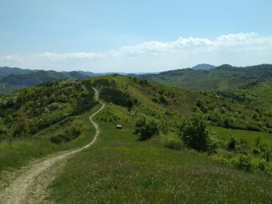
The itinerary starts from Botteghino di Zocca; after the locality Brinello, take the Via del Fantini (CAI 815) to Monte Brinello. After the first steep climb, continue along the ridge on the scenic trail that runs southward in a fairly challenging route. The ridge of Mount Brinello is perhaps one of the most splendid in the area: a continuous meandering among patches of broom, cultivated fields, groves and gullies.
The route arrives at the remains of Gorgognano, an important town, bombed and completely destroyed during WWII, except for the small cemetery.
Returning toward the starting point, you will meet the Zena Valley Whale, an installation commemorating the discovery of one of the most important fossils from the Pliocene period, 2 to 5 million years ago.


