Ciclovia delle Valli Bolognesi - 1 from Ozzano to Monterenzio
Ciclovia delle Valli Bolognesi - 1 from Ozzano to Monterenzio
Gps Track
Gps Track
- Start: Ozzano dell’Emilia
- Arrival: Monghidoro
- Total Length: 47,9 km
- Cycle type: Mountain bike
- Difficulty by Cycle: Hard
- Climb up: 1220 m
- Climb down: 1080 m
We start from Ozzano, from the “Forest of Life” park in Via Don Giovanni Minzoni, where the Flaminia Minor route begins, with an initial stretch of “single track,” until we reach the asphalt of Via del Pino, which we take by turning right.
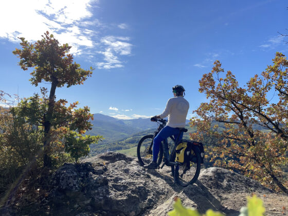
We go up until we cross the dirt road via del Pilastrino, which we take by turning left. After a short while we reach the viewpoint over the Abbadessa gullies, with views sweeping over the entire Po Valley; on clear days the Euganean hills stand out sharply in front of the background of the Alpine peaks. We arrive on the asphalt of Via Tolara near the Villa Torre Visitor Center – Parco dei gessi e dei Calanchi dell’Abbadessa, which we can reach with a short detour.
Shortly after we find the scenic ruins of the church of Santa Maria di Settefonti, which can be reached by a short path. Continuing downhill on the paved road, we temporarily abandon the route of the Flaminia Minor to quickly reach the valley floor, at the height of Mercatale. We cross the provincial road and pass on the other side of the Idice; we take right and we begin a long flat stretch of dirt road.
After about six kilometers we turn left onto Gaibola Street and we start climbing steeply on the first paved section. After 600 m the road becomes unpaved again, beginning to level out. The surface remains good until we reach an area of chalky outcrops, along a bristly stretch that will force the less skilled to some hand-bike stretches to overcome a few tricky passages. A little further and we reach the asphalt, where we turn left to keep to the ridge road. We have arrived to join the route of the Fantini Way, which we follow until we reach the Casola Badlands, where the road becomes a path and runs panoramically along the summit ridge of the badlands.
The trail continues around the farm in front of us (with a few short tears to be overcome probably by hand bike) until we reach a nice wide dirt road. Before starting to descend, a short detour to the left is recommended (about 600 m) to reach the isolated ruins of the church of Casola Canina. Back on track we quickly descend to the Zena valley floor at Botteghino di Zocca, a suitable place for a stop to replenish some energy.
We continue along the valley floor road for about seven kilometers until we reach the hamlet of Zena, where we join the Mater Dei road.
We take the dirt road on the left that leads us, with some challenging tears, to pass under the ruined castle of Zena and to reach via Faledola and then via Monte delle Formiche. On our right stands the so-called “Torre dell’Erede” ancient medieval watchtower. Before reaching Monte delle Formiche, the short detour on the left, in consonance with Fantini street, to the village of Tazzola and its interesting (and naïf) Botroid museum is highly recommended.
We take the paved road and we reach the Sanctuary of Monte delle Formiche with a final ascent of 240 meters.
After resting and enjoying the splendid view, we descend from the same road again, stopping for a moment at the small cemetery to honor the memory of the well-known speleologist and self-taught archaeologist from Bologna Luigi Fantini, who is buried here. When we reach the fork below we take left towards Cà del Monte.
We continue downhill along via Cà del Monte and then take left on the dirt road via Olgnano to reach Monterenzio (trail 811 – Traversata delle 5 valli) where the first stage ends and where we will rejoin the Flaminia Minor.
General warning: Many of the unpaved sections of this cyclovia are on clay soil, that becomes an extremely sticky and agglomerating mud in case of rain.


